Maps of United Kingdom
Share:


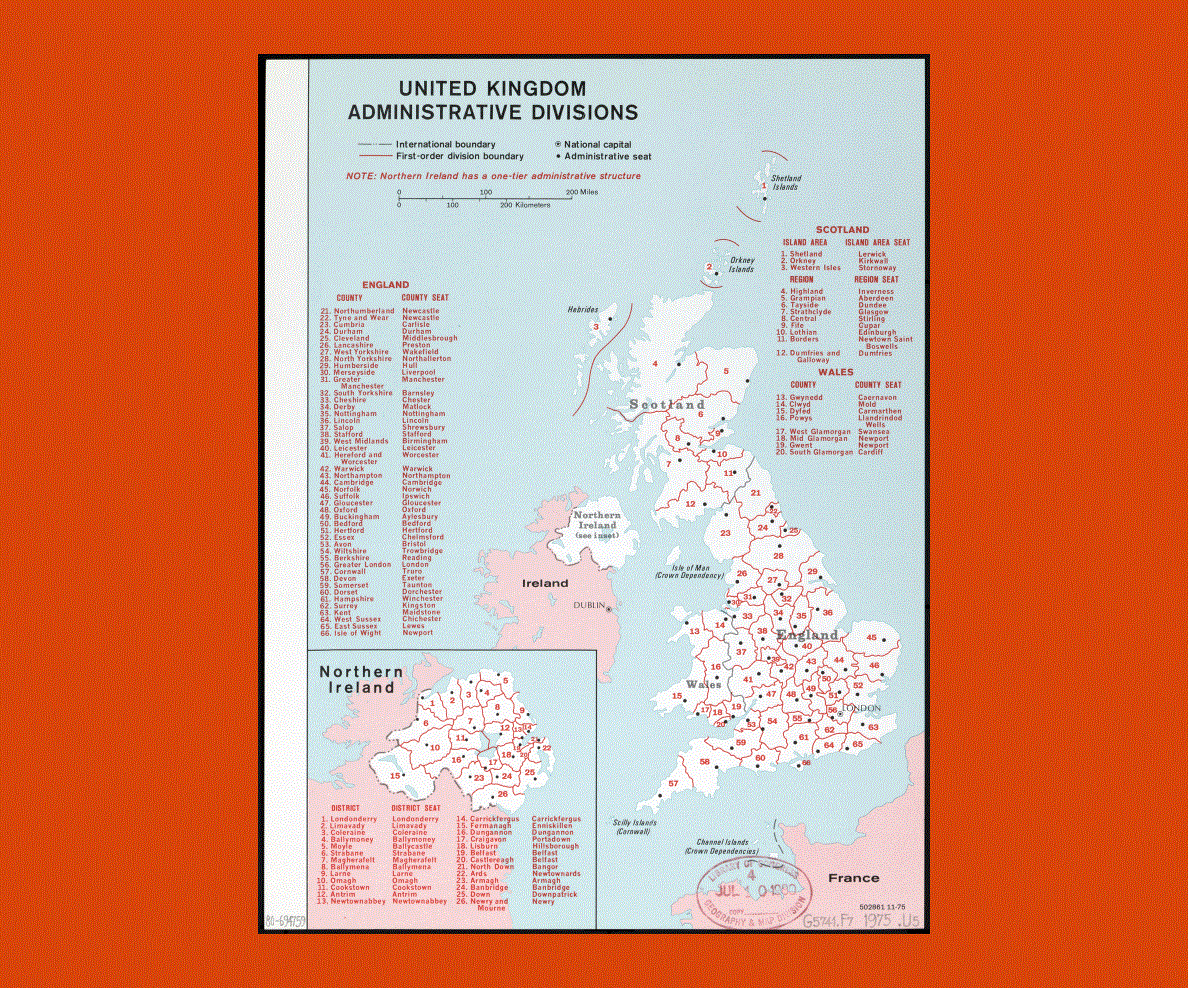
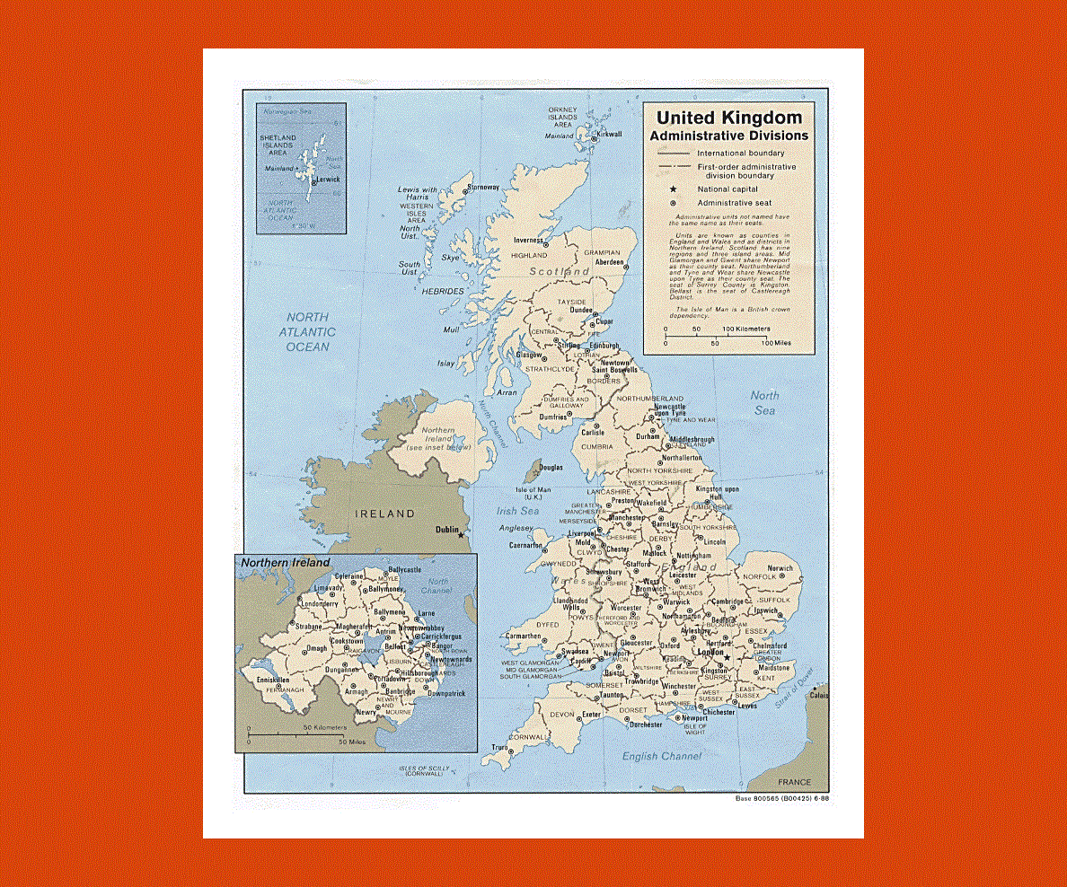
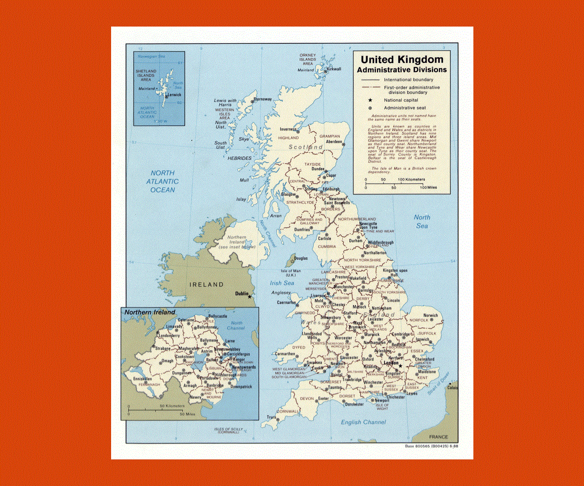
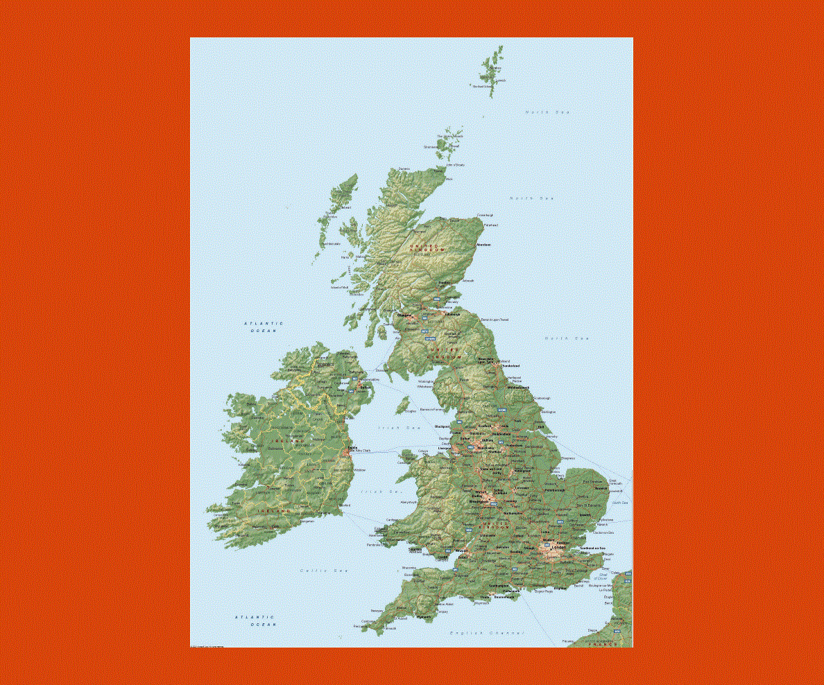
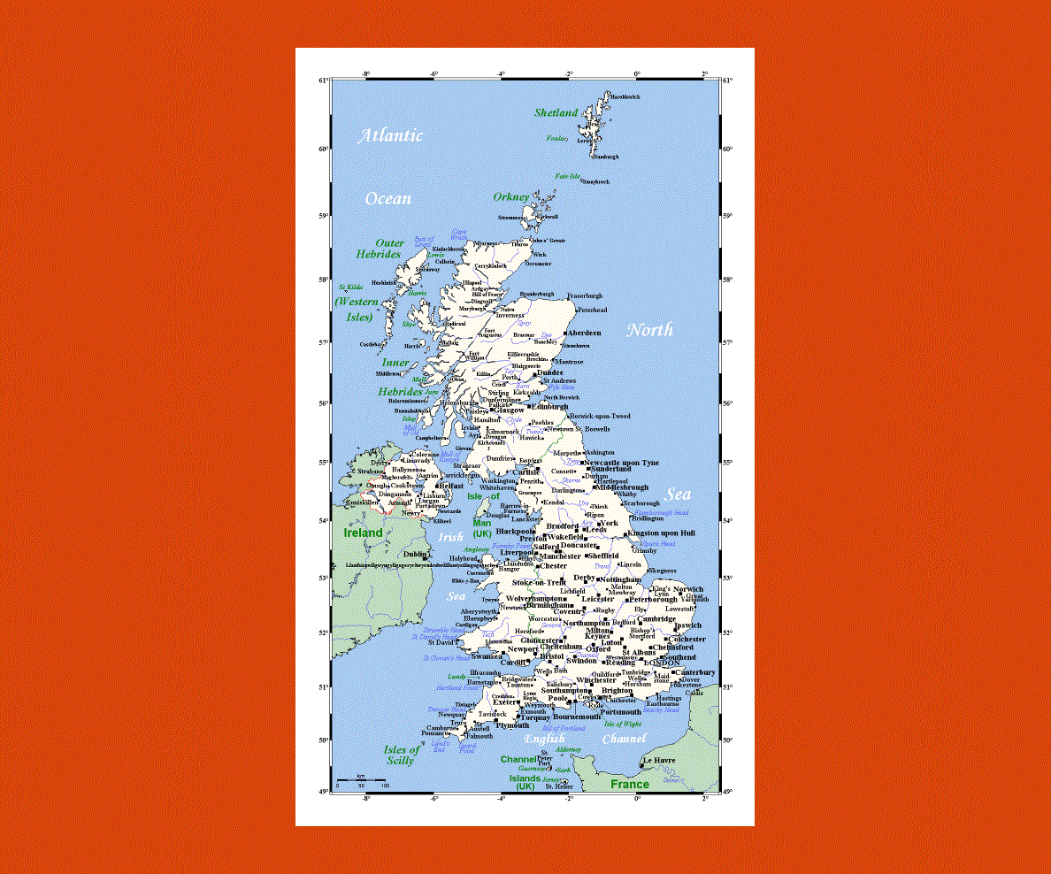
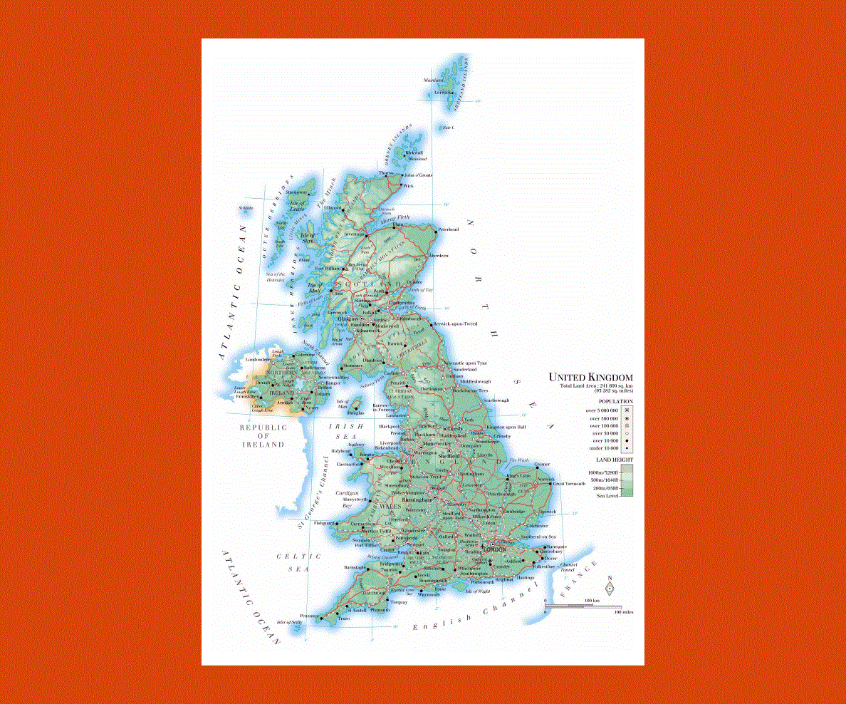
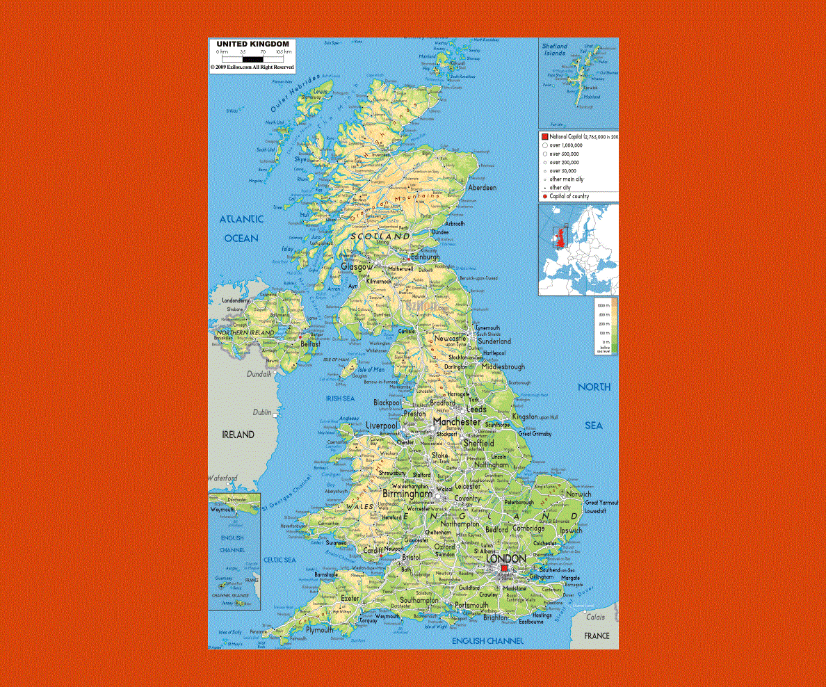
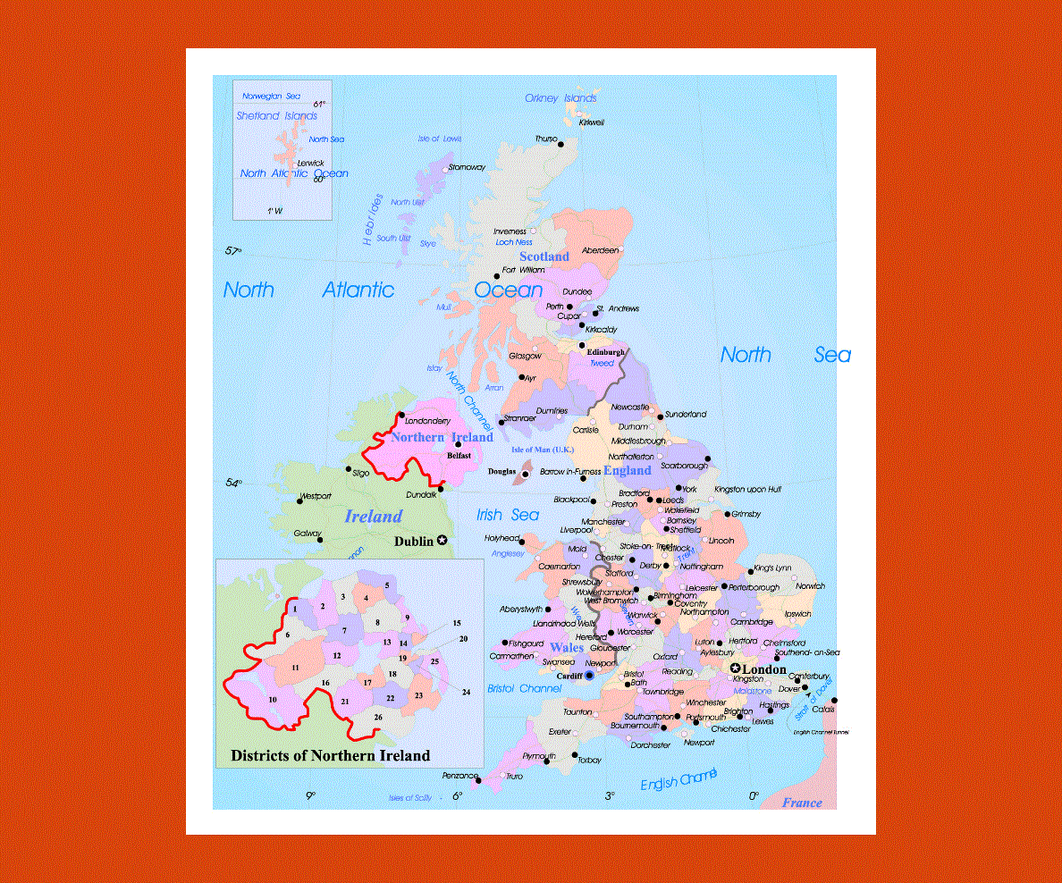
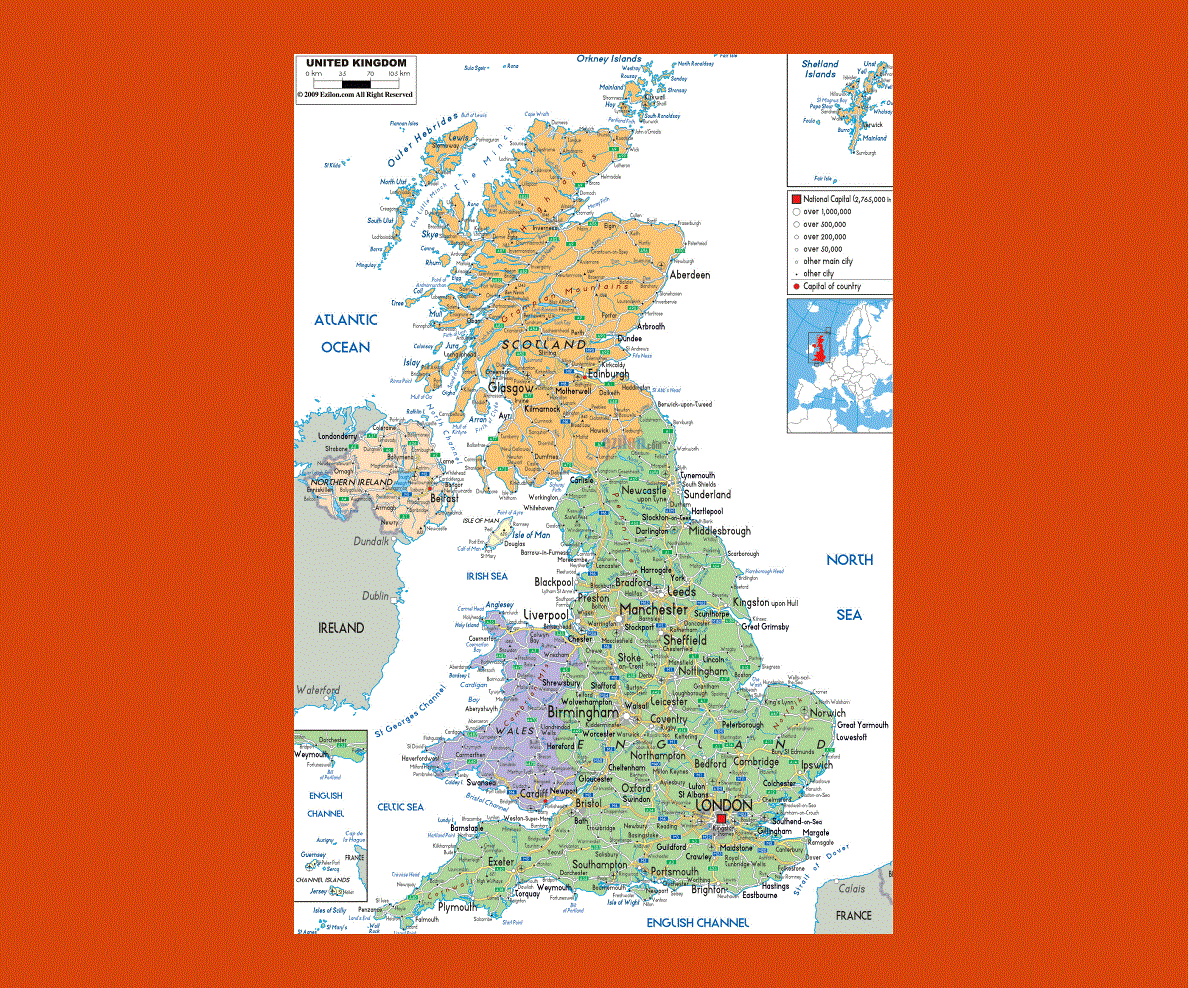
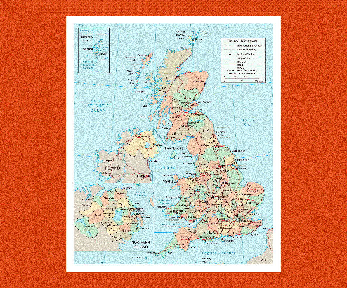
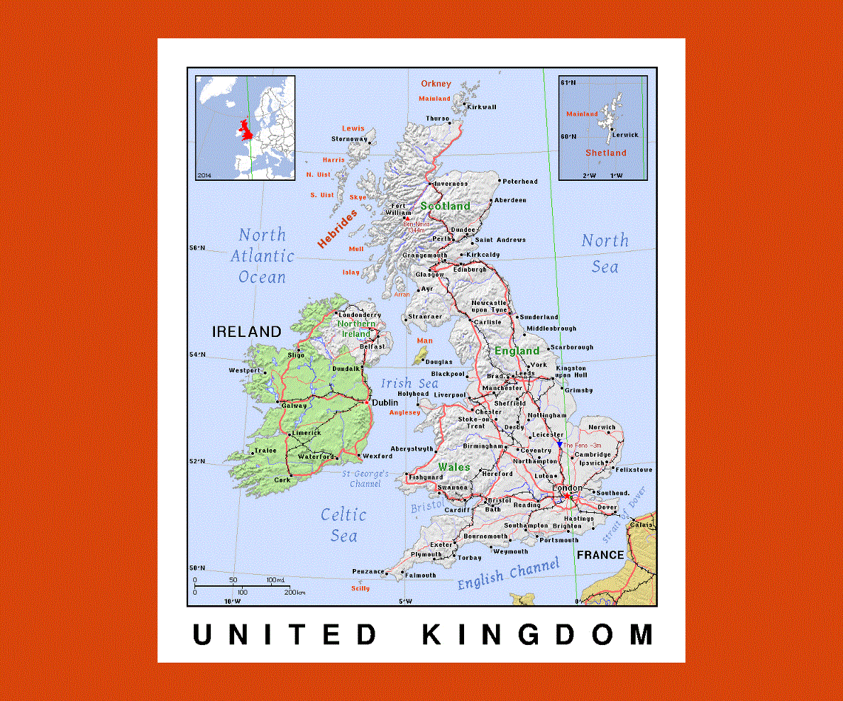
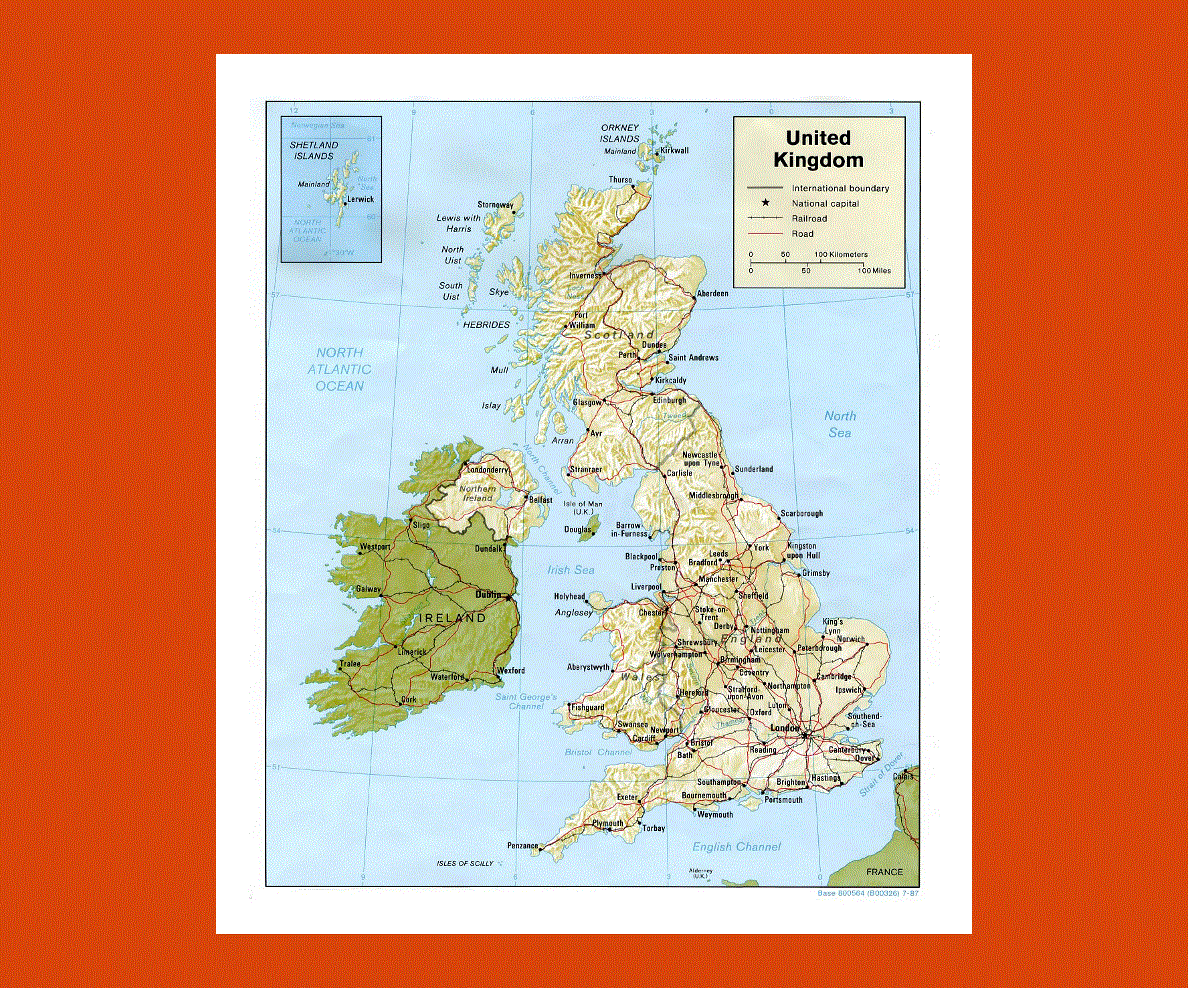
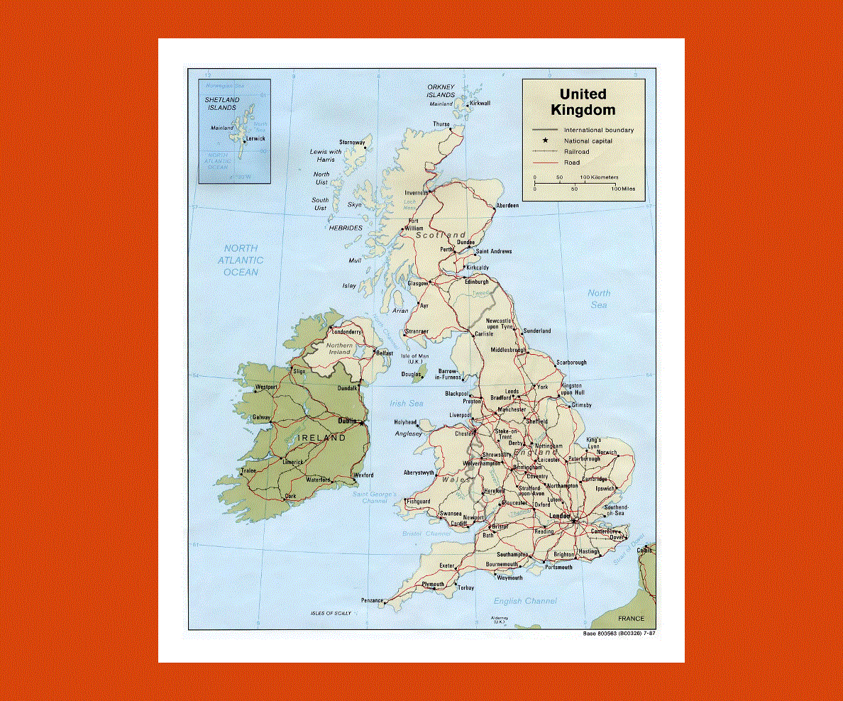
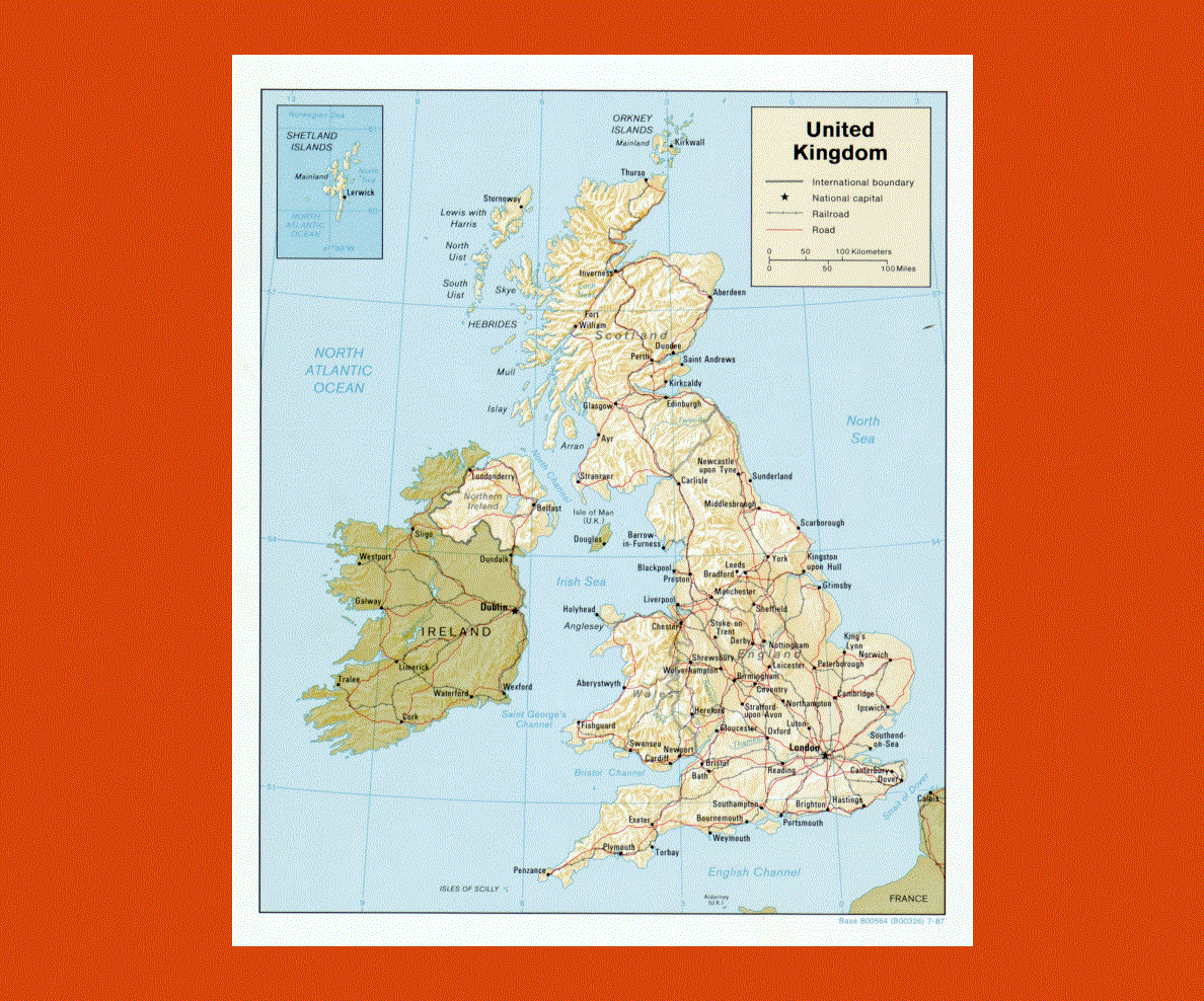
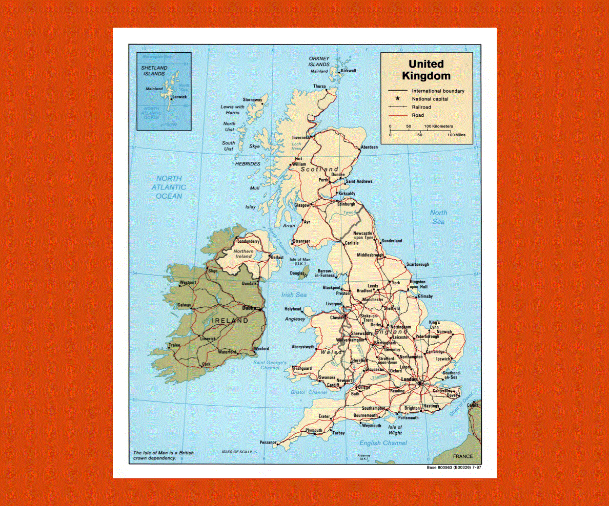
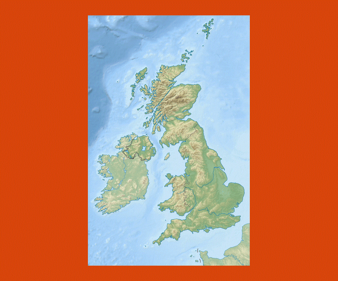
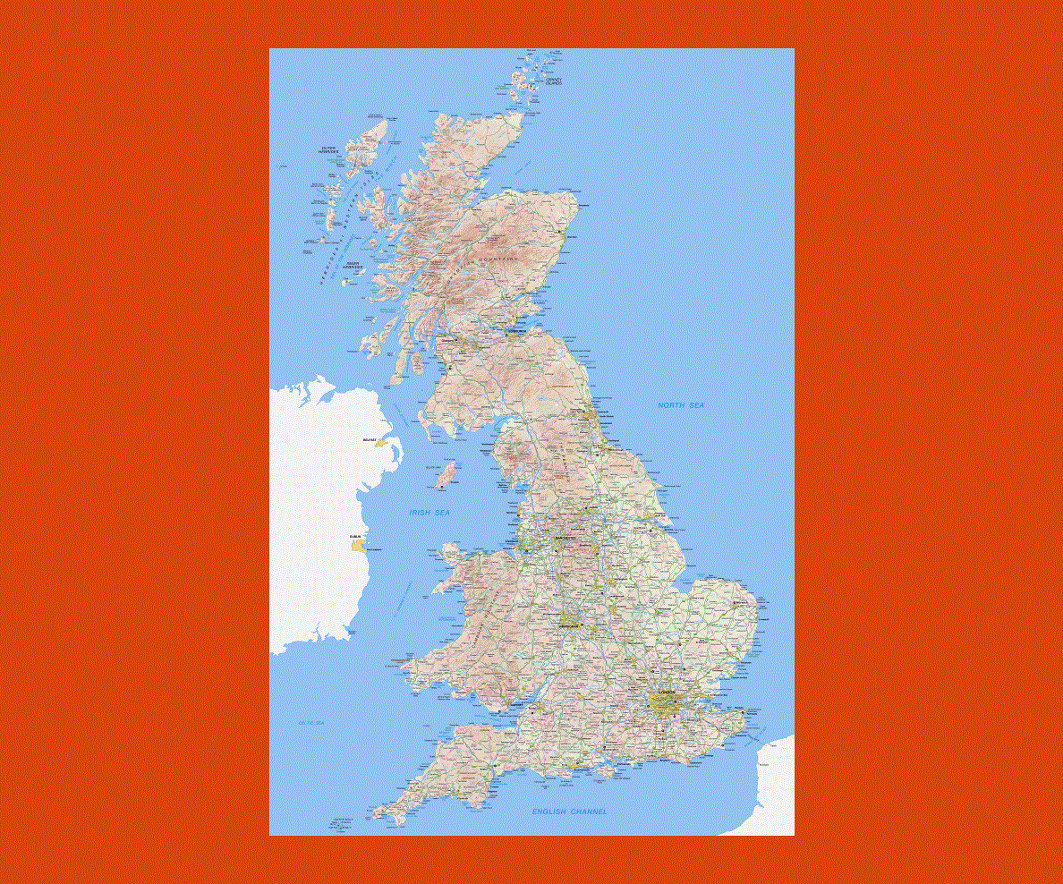
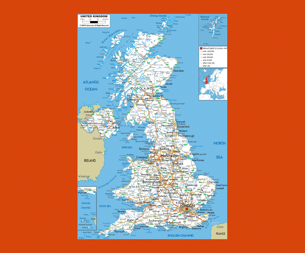
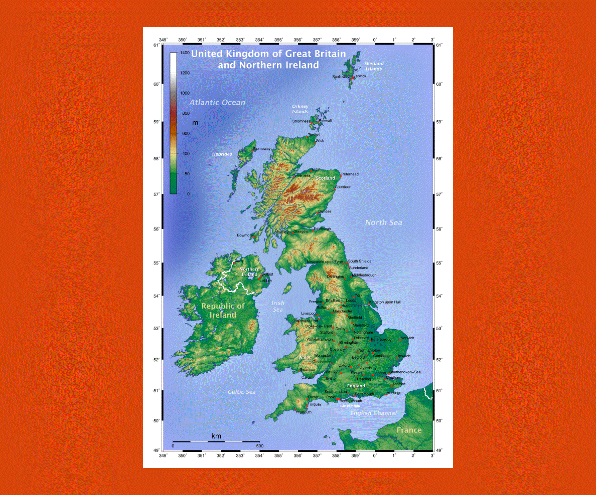
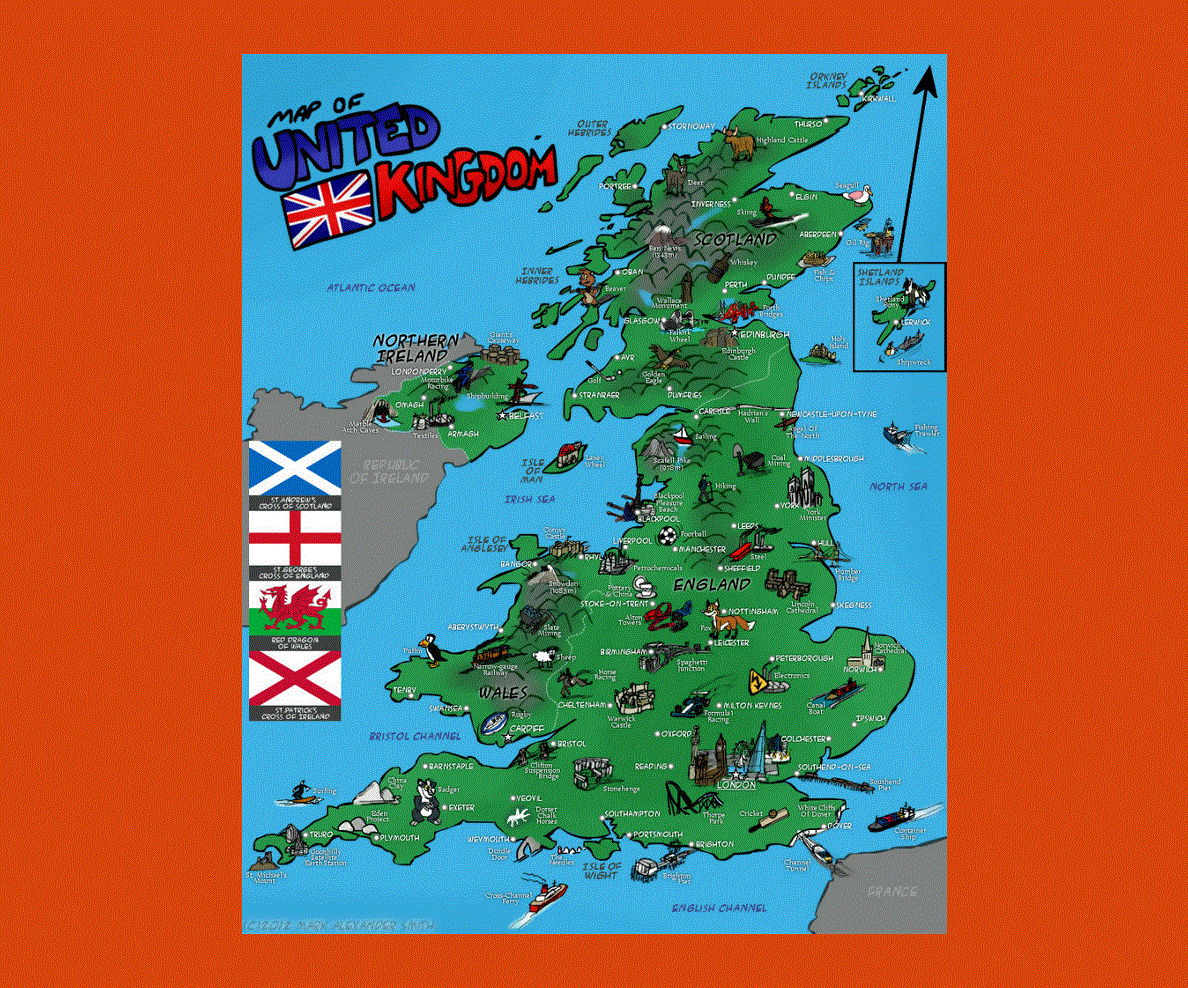
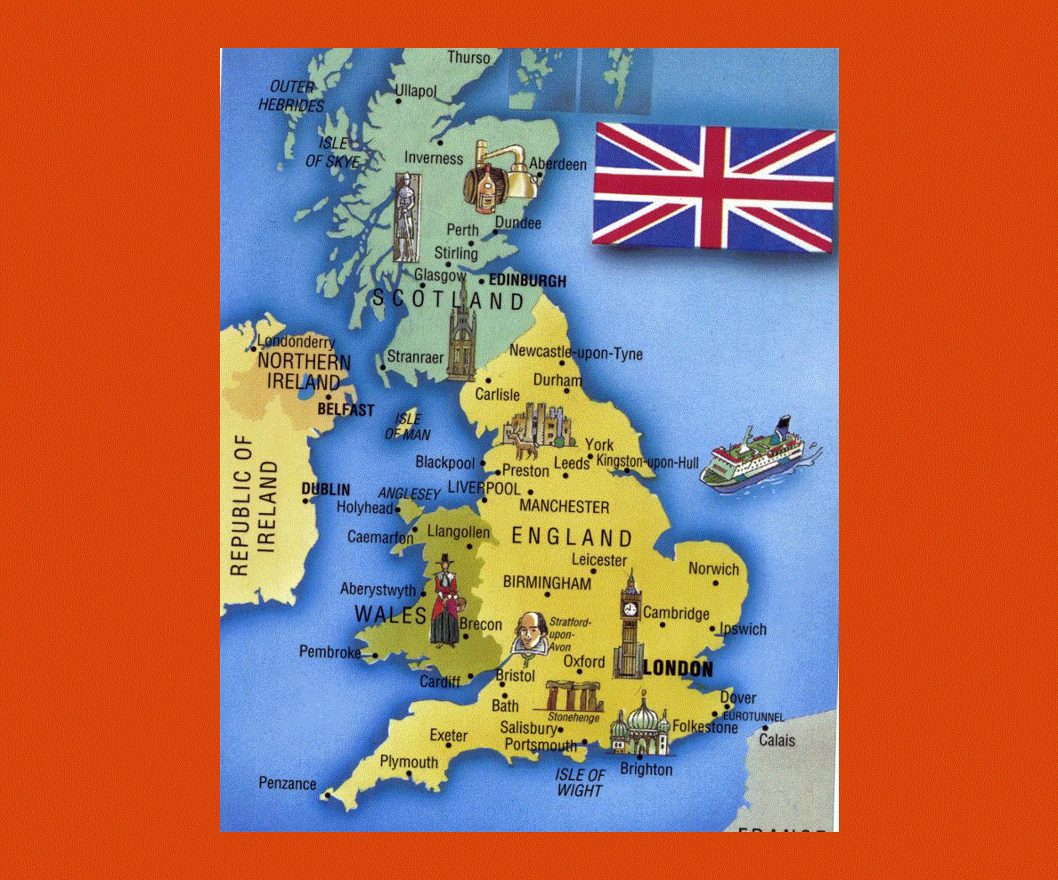
The United Kingdom, comprising of Northern Ireland and the Great Britain, is a country that is lies in Europe. It is basically an Island nation and it includes Great Britain and the northern part of Ireland. Great Britain is the largest Island in this nation and the Channel Tunnel connects this island to France.
The United Kingdom is surrounded by the Irish Sea, the English Channel, the North Sea and the Atlantic Ocean. The area of this country is about 245,000 square kilometers and it is located between the North Sea and the North Atlantic Ocean. The country experiences a temperate climate and it has rainfall throughout the year.
There is no official language in this country but most of the people converse in English. Four Celtic languages are also spoken in the United Kingdom and they are Cornish, Scottish Gaelic, Irish Gaelic and Welsh.
German and French are the two of the most common languages that are taught as second languages in schools. It is believed that about two hundred thousand Welsh speakers are living in England.
The main religion in United Kingdom is Christianity and this is followed by Judaism, Hinduism, Islam and Sikhism. According to a census in the year 2001, more than 70% of the population claimed that they were Christians.