Maps of Congo
Share:


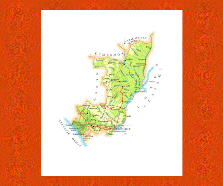
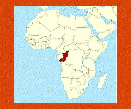
Situated on the West coast of Central Africa, with Brazzaville as its capital, Congo’s borders touch those of the Central African Republic, the Democratic Republic of Congo, Cameroon and Gabon. The official language is French but most of the population speaks Lingala, Munukutuba and Kikongo, while English is not spoken at all.
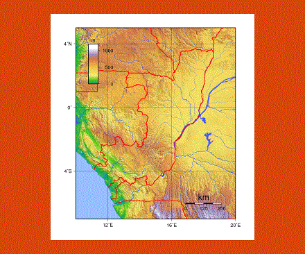
The coastal area looks out onto the Atlantic Ocean with lagoons scattered throughout its narrow sandy plain and the backdrop of the Mayombe Mountains. There are many swampy areas in this region with grassland and thick forests; here one can only travel around by boat up and down the many tributaries of the River Congo.
This land is rich in virgin forestland, waterfalls, rapids, swamps as well as wildlife. In the forests there are also quite a number of indigenous tribes who still safeguard their tradition and culture.
Brazzaville is a fascinating city with plenty of sights and places to explore during the day, while at nighttime the local musicians give a festive atmosphere to the city. Here there are museums to visit and mosques to admire as well as the markets of Oluendze and Moungali to browse through.
Exploring the Congo Rapids or water-skiing on the Congo and Kouillou rivers is a great way to enjoy the outdoors as is a trek to the Loufoulakari Falls, probably the most breathtaking waterfalls of the region.
Congo’s climate is equatorial with a very short rainy season from October to December and another longer one from January to May.
The people from Congo are called Congolese.