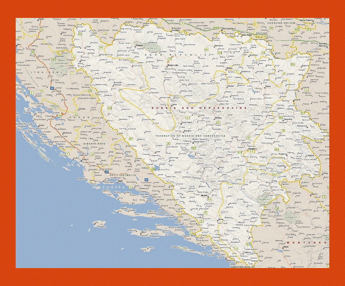
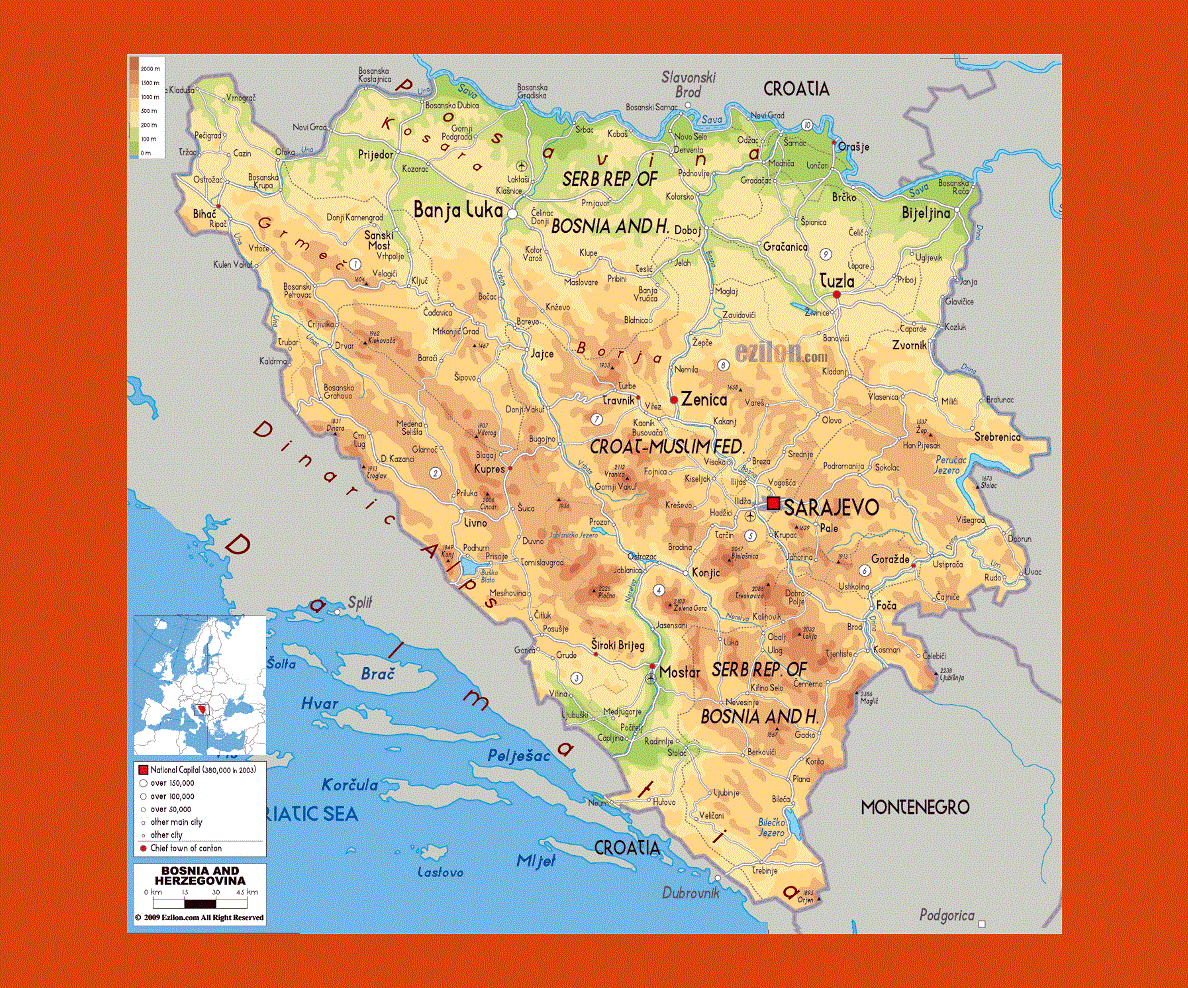
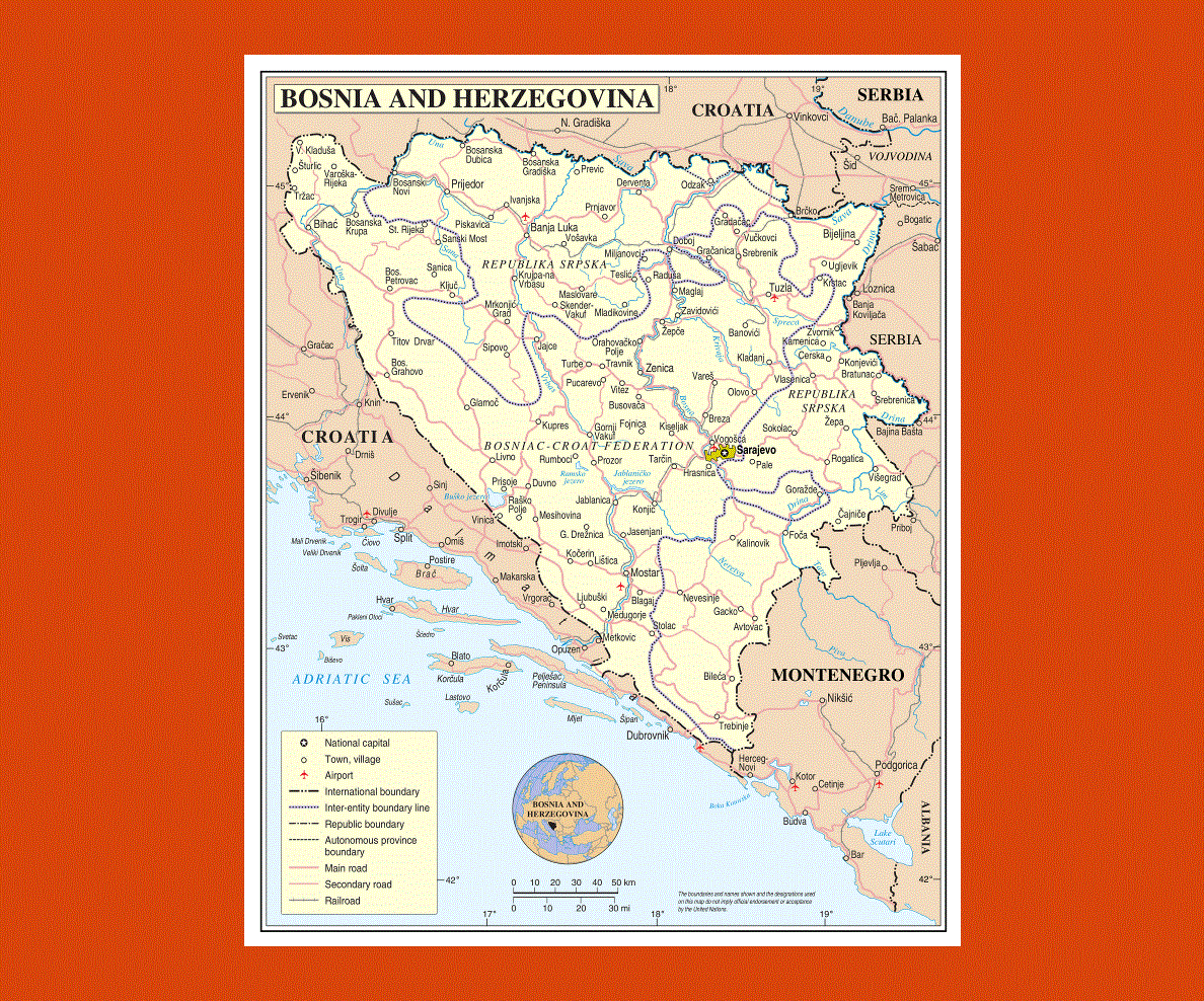
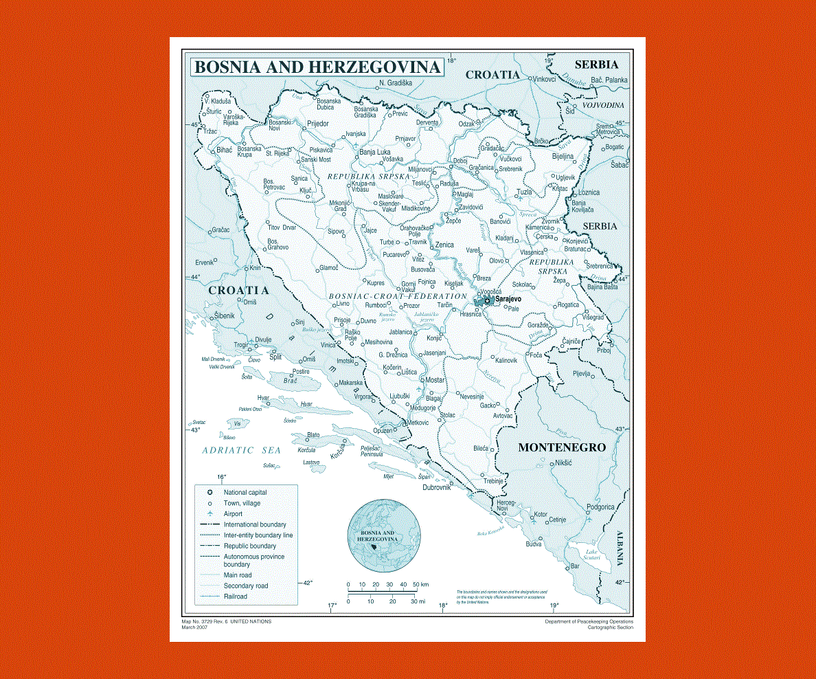
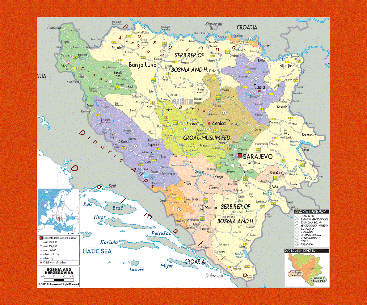
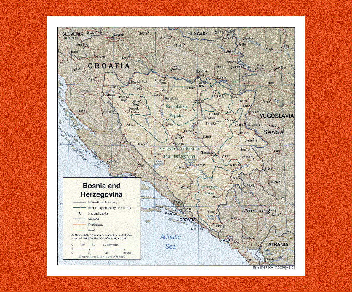
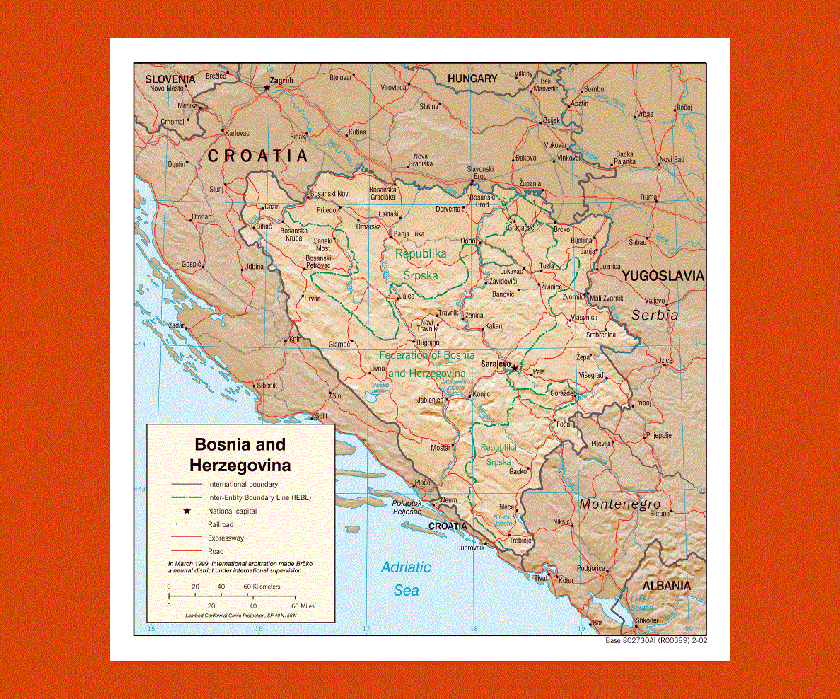
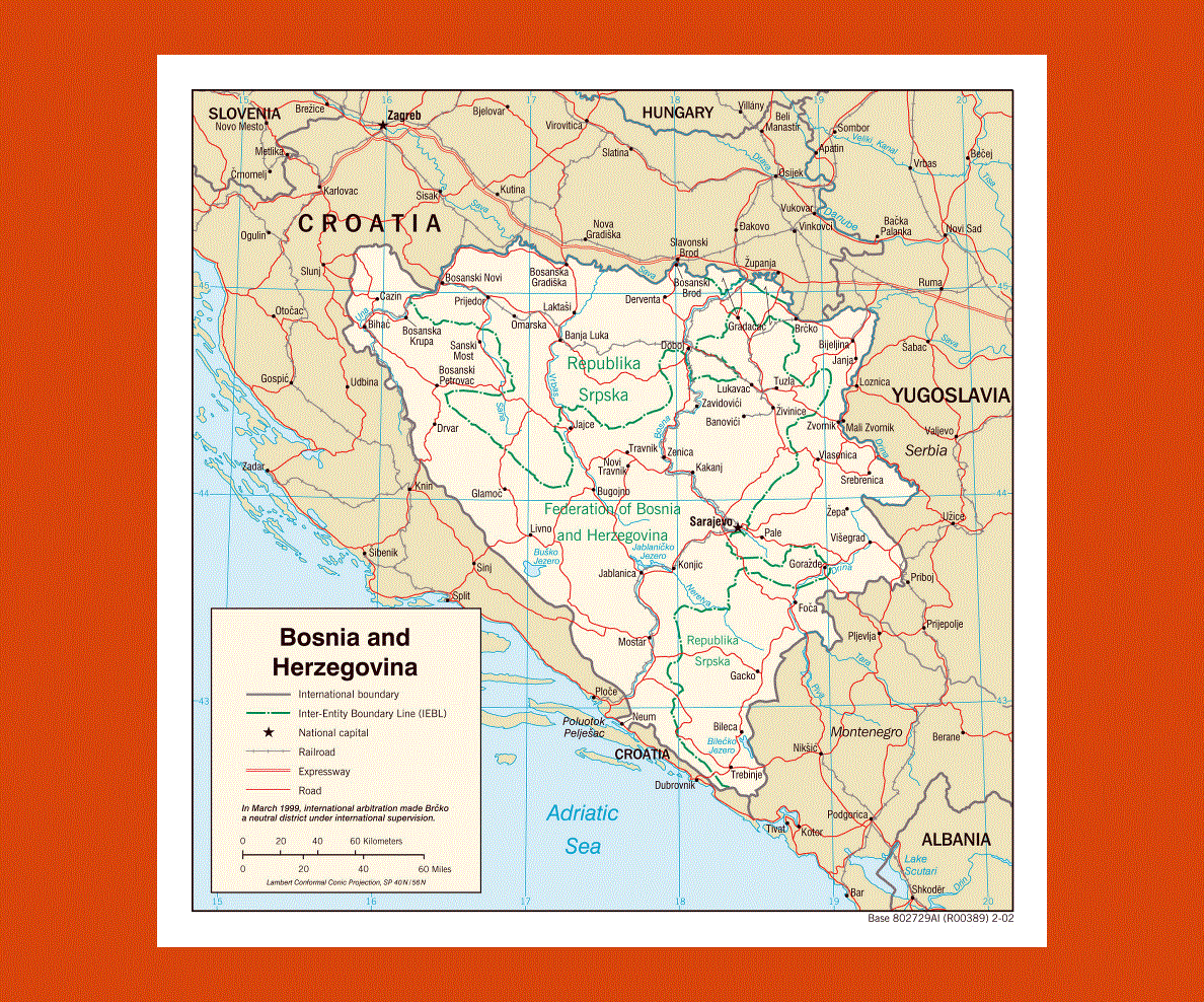
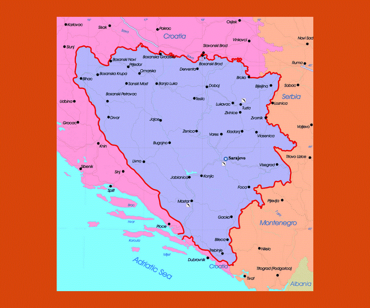
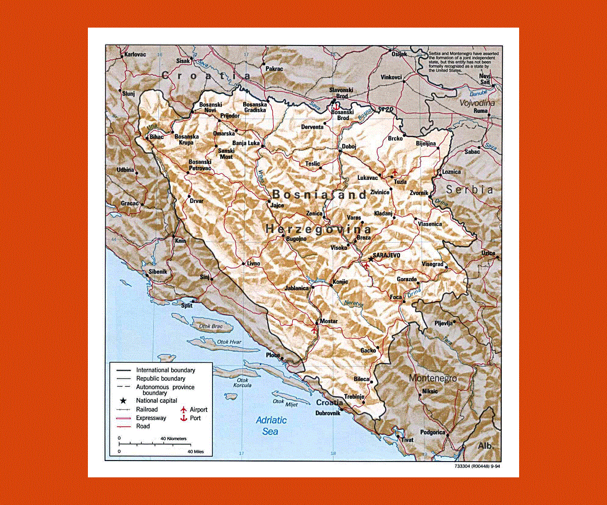
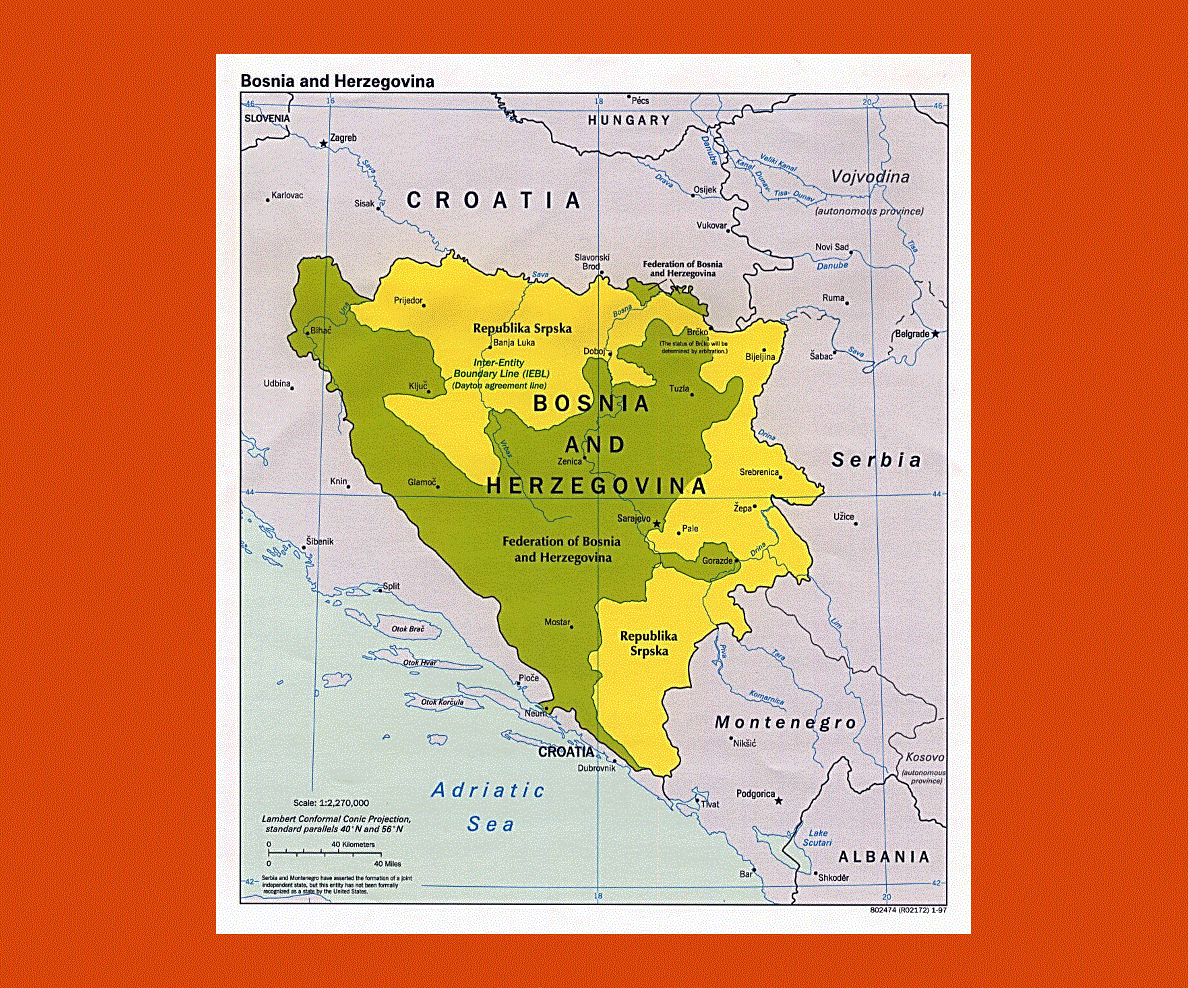
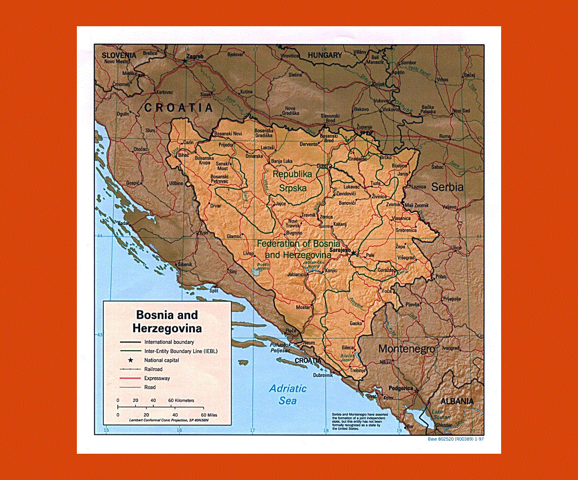
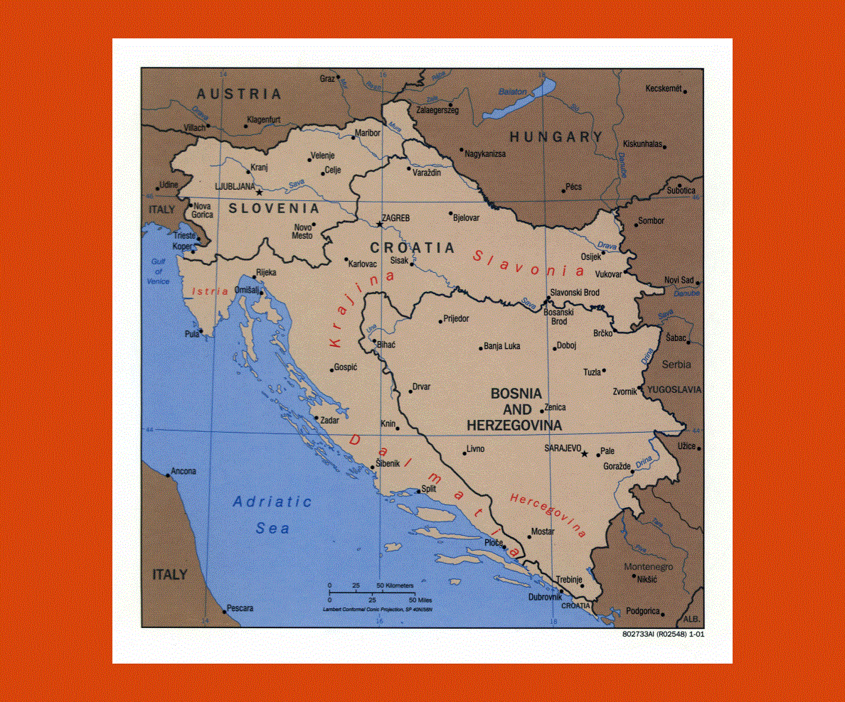
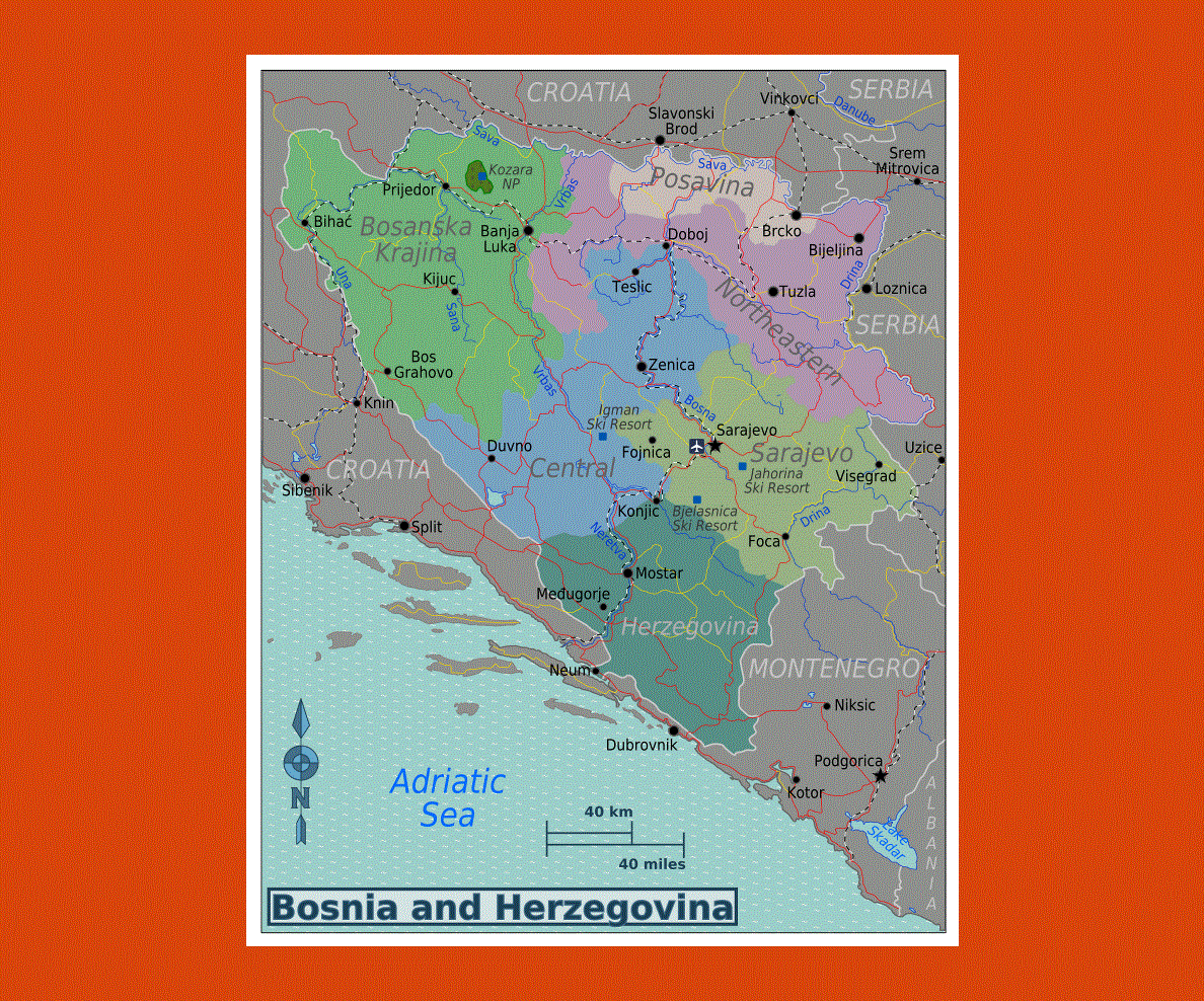
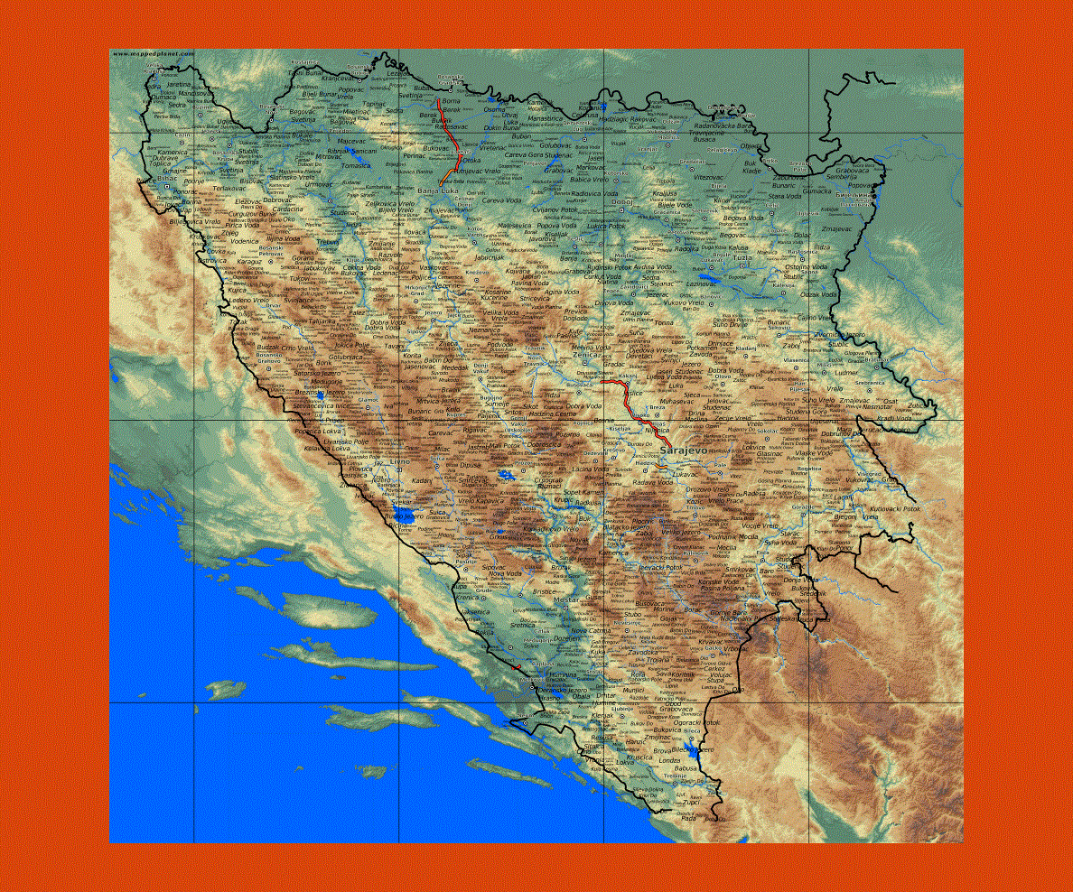
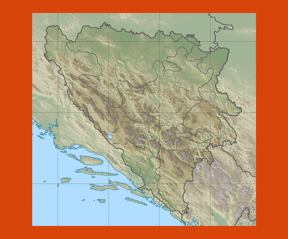
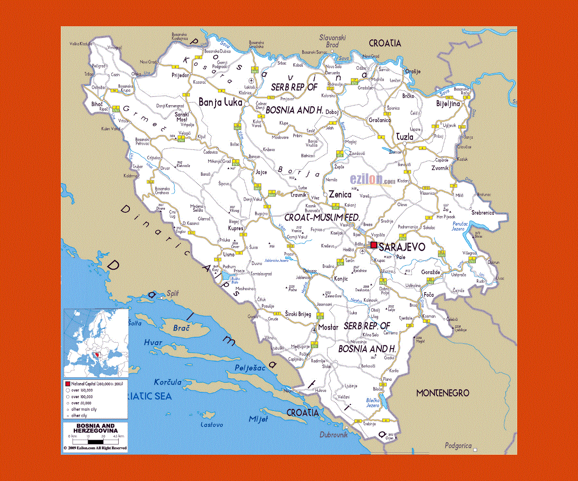
Maps of Bosnia and Herzegovina
Share:


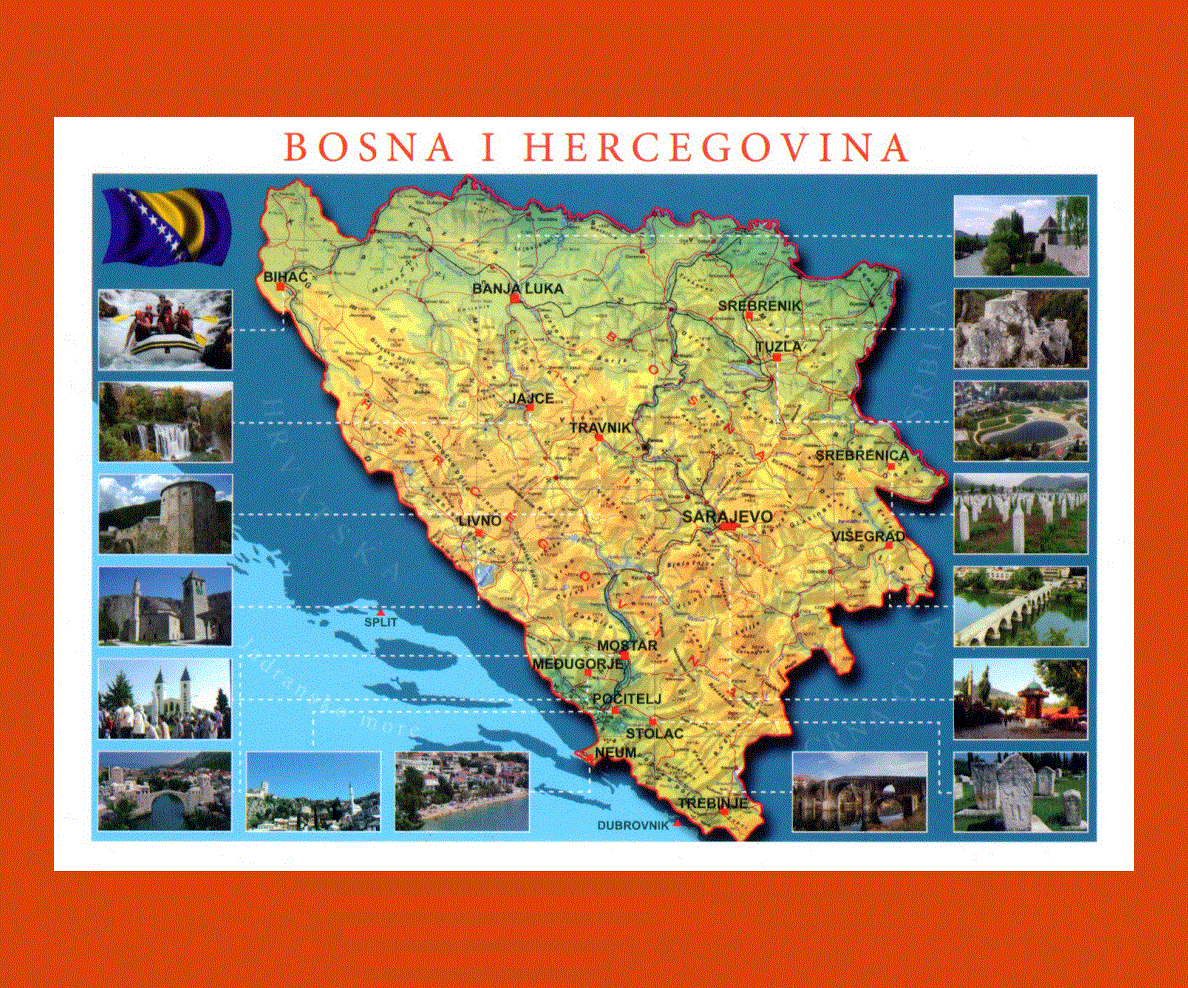
Although Bosnia and Herzegovina has suffered much from the past ravages of the Yugoslav war and Turkish dominion, there are still many sites to visit and appreciate in its cities, especially Sarajevo its capital.
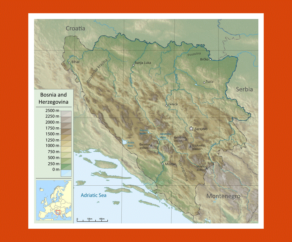
Bosnia and Herzegovina has a rich cultural heritage with historical fortresses, monasteries, Catholic shrines and magnificent ancient mosques. It is also a country bountiful in rich mountainous landscapes, which offer beautiful scenery and plenty to explore.
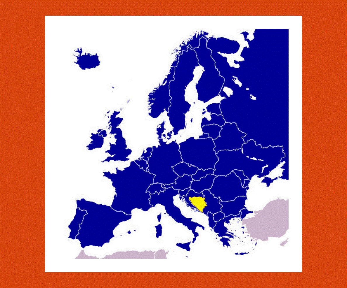
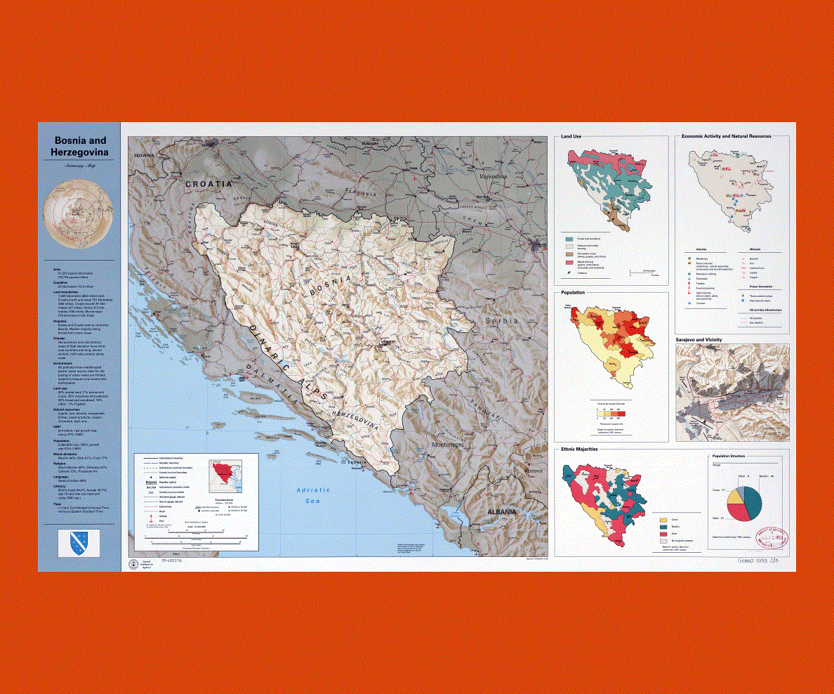
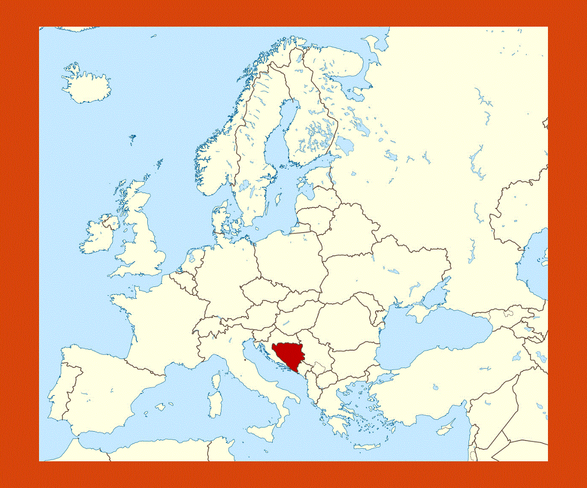
Situated in southeastern Europe the country borders with Serbia, Montenegro and Croatia with a small strip of coastline facing the Adriatic Sea, the official languages being Bosnian, Serbian and Croatian. While visiting Sarajevo one will notice a strong Turkish influence in the architecture and colorful bazaars as well as relics of the past Ottoman Empire. Banja Luka is another large city, which offers majestic sites including Orthodox monasteries and fortresses.
Medjugorje is the second most visited Catholic shrine of the world, where the Virgin Mary appeared to a group of children, and has been recognized as an official pilgrimage site by the Vatican.
The Sutjeska National Park is a magnificent site of untainted beauty, where wildlife and primeval forest trees still live in a well-balanced ecosystem, being one of the last remaining primeval forests in Europe.
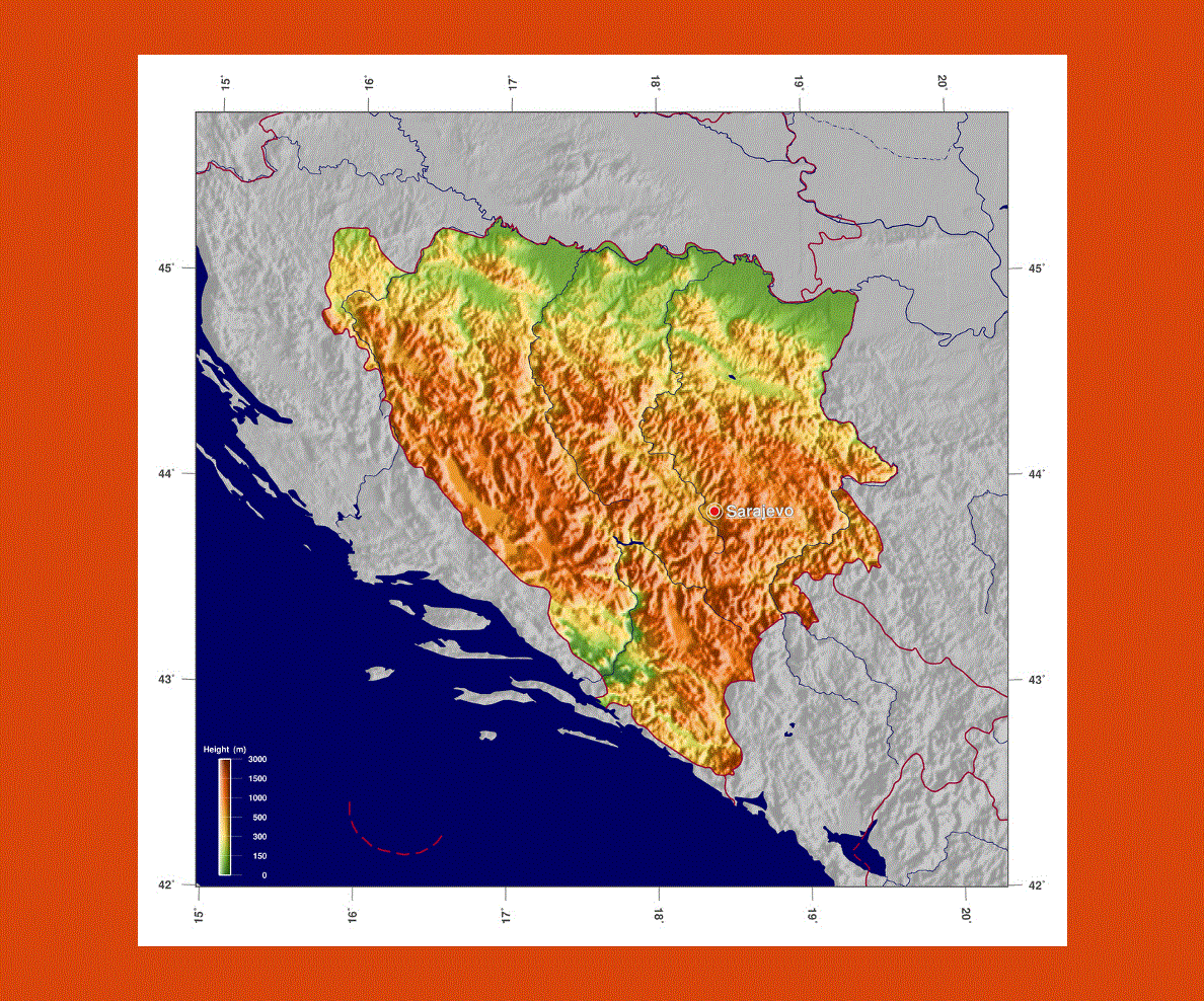
The climate is a moderate continental one, which can vary depending on the location, be it mountainous or near the major rivers that flow through the land. Usually the summers are very hot and the winters very cold.